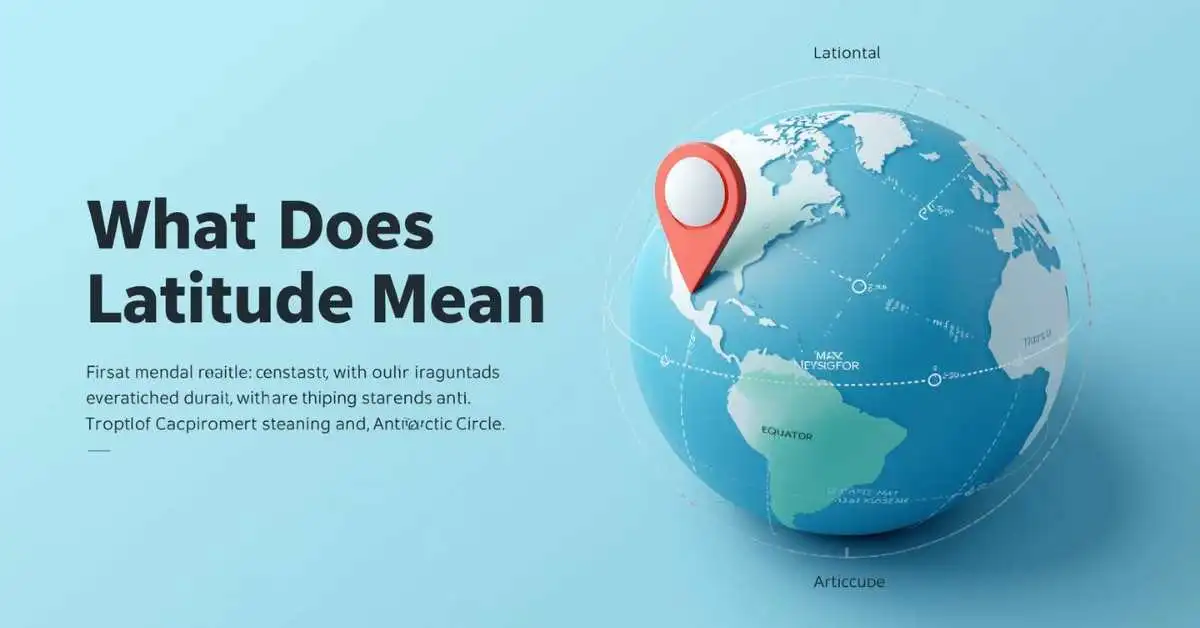
What does latitude mean? Latitude means how far a place is north or south of the Equator, measured in degrees. It helps us find places on Earth. It also helps explain maps, GPS, climate zones, and world geography.
Many people ask, what is the meaning of latitude, or what is latitude in geography. The answer is simple. Latitude is part of the system used to show the location of a place on a globe or map. It works with longitude to form coordinates.
This guide explains latitude in very simple words. You will learn what it means, how it works, how to read it on a map, and why it matters in real life.
Quick Answer: What Does Latitude Mean?
Simple Definition
Latitude is the distance of a place north or south of the Equator.
Easy Example
- 0° latitude = Equator
- 20° N = 20 degrees north of the Equator
- 45° S = 45 degrees south of the Equator
Why It Matters
Latitude helps with:
- maps
- GPS
- navigation
- climate zones
- geography lessons
This is the fastest answer to the question what does latitude mean.
What Is Latitude in Geography?
What Is the Meaning of Latitude?
In geography, latitude shows the north-south position of a place on Earth.
The Equator is the starting line. It is 0 degrees latitude. From there:
- places north of the Equator have north latitude
- places south of the Equator have south latitude
So, when someone asks what is latitude in geography, the answer is this: it tells how far a place is from the Equator.
Latitude Definition for Kids
A simple latitude definition for kids is:
Latitude tells how far up or down a place is from the middle of Earth.
The middle line is the Equator. Children often understand latitude faster when they think of the Equator as a belt around the Earth.
Example of Latitude in Geography
Here are easy examples:
- Quito, Ecuador is close to 0° latitude
- Cairo, Egypt is around 30° N
- Sydney, Australia is around 34° S
These numbers help us know where each place is on Earth.
How Does Latitude Work on a Map?
What Do Lines of Latitude Mean?
Many people ask, what do lines of latitude mean. These are imaginary lines that circle Earth from east to west.
They are also called parallels because they stay parallel to the Equator.
These lines help us measure distance north or south.
Example of Lines of Latitude
Imagine a globe with stripes going around it.
- the middle stripe is the Equator
- the stripes above it are north latitude
- the stripes below it are south latitude
That is how latitude lines help us locate places.
Table: Latitude Basics
| Term | Meaning |
|---|---|
| Latitude | Distance north or south of the Equator |
| Equator | 0° latitude |
| North Latitude | Above the Equator |
| South Latitude | Below the Equator |
| Parallels | Another name for lines of latitude |
How to Read Latitude on a Map
To read latitude on a map:
- Find the Equator
- Look at the horizontal lines
- Check the number of degrees
- See whether it is N or S
Example:
- 15° N means 15 degrees north of the Equator
- 22° S means 22 degrees south of the Equator
This makes the idea of what does latitude mean much easier to understand.
Latitude vs Longitude
Latitude vs Longitude: What Is the Difference?
A very common search is latitude vs longitude.
Here is the simple difference:
- Latitude shows north-south position
- Longitude shows east-west position
Latitude starts at the Equator.
Longitude starts at the Prime Meridian.
Example of Latitude vs Longitude
Take this coordinate:
40° N, 74° W
- 40° N is the latitude
- 74° W is the longitude
Together, these numbers help find an exact place on Earth.
Table: Latitude vs Longitude
| Feature | Latitude | Longitude |
|---|---|---|
| Shows | North-south position | East-west position |
| Starting Line | Equator | Prime Meridian |
| Direction | North or South | East or West |
| Line Shape | Horizontal on maps | Vertical on maps |
| Example | 25° N | 80° W |
Easy Memory Trick
A simple memory trick:
- Latitude is flat
- Longitude is long
This is not a perfect rule, but it helps beginners remember the basic idea.
What Is 0 Degrees Latitude?
What Is 0 Degrees Latitude Called?
Another common question is what is 0 degrees latitude.
The answer is simple:
0 degrees latitude is called the Equator.
The Equator is the line that divides Earth into two halves:
- Northern Hemisphere
- Southern Hemisphere
Why the Equator Matters
The Equator matters because it is the starting point for latitude.
Every latitude number is measured from this line.
Example of 0 Degrees Latitude
Places near the Equator often stay warm through most of the year.
Examples of places near the Equator include parts of:
- Ecuador
- Brazil
- Kenya
- Indonesia
That is one reason the Equator is important in both geography and climate studies.
What Does Latitude Mean
Latitude describes how far north or south any place sits from the equator. It is measured in degrees, from 0° at the equator up to 90° at the North or South Pole. This simple number helps people understand climate patterns, daylight hours, and seasonal changes across the planet. Higher latitudes usually mean colder weather and longer winter nights, while lower latitudes enjoy warmer temperatures year-round. Navigators, scientists, and everyday map users rely on latitude to pinpoint exact locations on Earth with accuracy and ease.
Example 1: New York City sits at about 40°N latitude, placing it in a temperate zone with four distinct seasons.
Example 2: Singapore lies near 1°N latitude, giving it a hot, tropical climate almost every day of the year.
[Context and how people use it]
People use latitude every day when checking weather apps, planning travel, or reading maps to understand why some cities feel warmer than others.
Students and travelers also rely on it to compare climates between different countries quickly and clearly.
Latitude
Latitude is the geographic measurement that shows a location’s distance north or south of the equator. Written in degrees, it forms invisible horizontal lines that circle the globe. These lines help create the global grid system used in GPS devices, atlases, and online maps. Understanding latitude lets anyone instantly grasp whether a place experiences tropical heat, mild seasons, or polar cold. It remains one of the most practical tools for describing Earth’s surface in simple, universal terms that work everywhere.
Example 1: Cairo, Egypt, has a latitude of roughly 30°N, explaining its warm desert climate.
Example 2: Reykjavik, Iceland, sits near 64°N, which accounts for its cool summers and long winter nights.
[Context and how people use it]
Travelers check latitude when choosing holiday destinations so they know what weather to expect.
Teachers use it in classrooms to help students visualize why countries near the equator stay hot while polar regions stay cold.
Latitude Definition
Latitude is defined as the angular distance of a point on Earth’s surface measured north or south from the equator. It ranges from 0° at the equator to 90° at the poles and is always written with N or S to show the hemisphere. This measurement forms the foundation of modern mapping and navigation systems. By knowing a place’s latitude, anyone can quickly estimate its climate zone, average temperature range, and length of day throughout the year without needing complex tools.
Example 1: The latitude of Tokyo is approximately 35°N, placing it in a humid subtropical climate zone.
Example 2: Cape Town has a latitude of about 34°S, giving it mild winters and warm, dry summers.
[Context and how people use it]
Meteorologists use latitude daily when forecasting weather patterns across different regions.
App developers include latitude data so users can see exact locations on digital maps with one glance.
What Is Latitude
Latitude is a geographic coordinate that tells how far a location sits from the equator toward the North or South Pole. Measured in degrees, minutes, and seconds, it creates a series of parallel lines that run east-west around the planet. These lines make it possible to describe any spot on Earth with precision. Latitude directly influences sunlight intensity, temperature, and seasonal variation, which is why it plays such an important role in climate science, agriculture, and global travel planning.
Example 1: Miami sits at 25°N latitude, which explains its subtropical weather and mild winters.
Example 2: Oslo, Norway, is located at 60°N, resulting in cool summers and very short winter days.
[Context and how people use it]
Sailors and pilots depend on latitude to stay on course during long journeys across oceans or continents.
Gardeners check local latitude to decide which plants will thrive in their climate zone.
Latitude Meaning
The meaning of latitude centers on measuring north-south position on Earth relative to the equator. It is expressed in degrees and forms the horizontal part of the global coordinate system. This concept allows people to compare locations instantly and understand environmental differences caused by the angle of the sun. From weather reports to flight paths, latitude provides a shared language that helps everyone describe and navigate the world more effectively and accurately every single day.
Example 1: Mexico City’s latitude of 19°N places it in a high-altitude subtropical region with pleasant temperatures.
Example 2: Anchorage, Alaska, at 61°N, experiences extreme seasonal changes in daylight and temperature.
[Context and how people use it]
People open map apps and instantly see latitude numbers that help them share exact locations with friends.
Climate researchers study latitude to explain why some regions face more intense heatwaves than others.
Latitude in a Sentence
Latitude appears in everyday sentences when people describe location or climate. For example: “Cities at higher latitudes usually have colder winters.” Another common use is: “The ship recorded its latitude to stay on the correct sailing route.” These simple statements show how the word fits naturally into conversations about geography, travel, and weather. Using latitude in a sentence helps make complex map ideas clear and useful for students, travelers, and professionals alike.
Example 1: “Because of its low latitude, Bangkok stays hot and humid throughout the entire year.”
Example 2: “Pilots always confirm the plane’s latitude before beginning the final approach to the runway.”
[Context and how people use it]
Writers and teachers include latitude in sentences to teach location skills in a clear, practical way.
Travel bloggers use the word when describing why certain destinations feel warmer or cooler than expected.
Definition of Latitude
The definition of latitude is the measurement of distance north or south of the equator, expressed in degrees from 0° to 90°. It forms imaginary parallel lines that help create Earth’s coordinate grid. This definition is essential for mapping, navigation, and understanding global climate zones. Once someone knows a place’s latitude, they can immediately estimate sunlight levels, average temperatures, and seasonal patterns without needing extra equipment or complicated calculations.
Example 1: According to the definition of latitude, Quito sits almost exactly on the equator at 0°.
Example 2: Using the same definition, the South Pole is recorded as 90°S latitude.
[Context and how people use it]
Students memorize the definition of latitude early so they can read maps and globes with confidence.
GPS systems rely on this definition to calculate exact positions for drivers, hikers, and delivery services.
How Latitude Works
Latitude works by measuring the angle between a location and the equator as seen from Earth’s center. The equator is set at 0°, and the angle increases as one moves toward either pole. These measurements create parallel lines that never meet, allowing precise north-south positioning. Combined with longitude, latitude powers every modern mapping tool. The system works the same way for ships at sea, planes in the sky, and smartphones in your pocket, making global location tracking simple and reliable.
Example 1: A GPS device calculates latitude by measuring satellite signals to determine how far north or south you are.
Example 2: Weather satellites use latitude bands to track storms moving from the tropics toward higher latitudes.
[Context and how people use it]
Airline systems constantly update latitude data so flights stay on the safest and most efficient routes.
Farmers study how latitude works to choose the best planting dates based on local sunlight patterns.
Latitude Definition Geography
In geography, the latitude definition describes the north-south position of any point on Earth measured from the equator in degrees. Geographers use this definition to divide the planet into climate zones, study ocean currents, and explain vegetation patterns. Parallel lines of latitude appear on every standard map and globe. This geographic concept remains one of the most fundamental tools for understanding how location shapes weather, daylight, ecosystems, and human settlement across the entire planet.
Example 1: Geography textbooks show the Tropic of Cancer at 23.5°N latitude as the northern limit of the tropics.
Example 2: The Arctic Circle at 66.5°N latitude marks where continuous daylight or darkness can occur in summer or winter.
[Context and how people use it]
Geography teachers use the latitude definition to help students compare climates between continents.
Cartographers apply it every day when drawing accurate maps that show real-world distances and zones.
Why Is Latitude Important?
Why Is Latitude Important in Geography?
Many people ask, why is latitude important.
Latitude is important because it helps us:
- find places on Earth
- read maps
- use GPS
- study climate
- understand world regions
Without latitude, it would be much harder to describe exact locations.
Why Is Latitude Important for Maps and GPS?
Latitude is used in:
- smartphone maps
- GPS devices
- navigation systems
- shipping routes
- air travel
- geographic coordinate systems
When you share a location pin, latitude is often part of the data.
Example from Real Life
A pilot, sailor, or map app uses latitude and longitude to find the right place.
This is why geographic coordinates matter so much.
How Does Latitude Affect Climate?
How Does Latitude Affect Climate?
A very helpful related question is how does latitude affect climate.
Latitude affects climate because sunlight hits Earth at different angles.
- places near the Equator get more direct sunlight
- places far from the Equator get less direct sunlight
That is why low latitudes are often warmer, while high latitudes are often cooler.
Example of Latitude and Climate
Compare these two places:
- a city near the Equator usually has warm weather most of the year
- a city near the Arctic Circle usually has colder weather and bigger seasonal changes
So, latitude helps explain temperature, seasons, and climate zones.
Table: Latitude and Climate Zones
| Latitude Zone | General Climate |
|---|---|
| Near 0° | Tropical and warm |
| Around 23.5° to 40° | Warm to mild |
| Mid-latitudes | Temperate |
| Near 66.5° and beyond | Polar and very cold |
Why Sunlight Changes by Latitude
This happens because Earth is curved.
Sunlight is more direct near the Equator. It spreads out more near the poles.
That simple fact explains a lot about world climate.
Major Lines of Latitude You Should Know
Important Latitude Lines
Some lines of latitude are very important in geography.
Here are the main ones:
| Line | Latitude |
|---|---|
| Equator | 0° |
| Tropic of Cancer | 23.5° N |
| Tropic of Capricorn | 23.5° S |
| Arctic Circle | 66.5° N |
| Antarctic Circle | 66.5° S |
| North Pole | 90° N |
| South Pole | 90° S |
Example of Why These Lines Matter
These lines help us understand:
- tropical zones
- temperate zones
- polar regions
- daylight patterns
- Earth’s climate system
For example, the Tropic of Cancer and Tropic of Capricorn help mark the tropical region. The Arctic Circle and Antarctic Circle help mark the polar zones.
Related Geography Entities
These terms are closely linked to latitude:
- Earth
- globe
- map
- Equator
- hemispheres
- poles
- Prime Meridian
- coordinates
- GPS
- cartography
- navigation
- climate zones
- parallels
- degrees
These related entities help strengthen topical relevance and semantic SEO.
Real Examples of Latitude
Example 1: A Place Near the Equator
A city near 0° latitude is close to the Equator.
That usually means:
- strong sunlight
- warm temperatures
- small seasonal changes
Example 2: A Mid-Latitude Place
A place around 40° N or 40° S is in the mid-latitudes.
That often means:
- four seasons
- milder sunlight than the tropics
- bigger weather changes during the year
Example 3: A High-Latitude Place
A place near 70° N is in a high-latitude area.
That often means:
- cold climate
- short winter days
- long summer days
These examples make the meaning of latitude easier to see in real life.
Common Mistakes About Latitude
Mistake 1: Thinking Latitude Means East and West
That is wrong.
Latitude means north and south.
Longitude means east and west.
Mistake 2: Thinking Latitude Lines Go Up and Down
They do not.
Lines of latitude go around Earth from east to west.
But they measure how far north or south a place is.
Mistake 3: Forgetting the Equator
Latitude always starts from the Equator.
That is why the Equator is so important in geography.
Example of a Common Error
- 30° N is not the same as 30° S
- one is north of the Equator
- the other is south of the Equator
The degree number may be the same, but the location is different.
How to Understand Latitude Fast
One-Sentence Answer
Here is the simplest answer again:
Latitude means how far a place is north or south of the Equator, measured in degrees.
Three Easy Words to Remember
Think of latitude like this:
- location
- lines
- degrees
Example for Quick Recall
If someone asks you, what does latitude mean, you can say:
“It tells where a place is above or below the Equator.”
That is short, correct, and easy to remember.
FAQs
Q: What does latitude mean in geography
A: Latitude is the distance north or south of the Equator, measured in degrees.
Q: What does latitude mean for kids
A: Latitude tells kids how far a place is north or south of the Equator.
Q: Longitude
A: Longitude is the distance east or west of the Prime Meridian, measured in degrees.
Q: Simple Definition of latitude
A: Latitude is a measurement showing how far north or south a place is from the Equator.
Q: Latitude meaning freedom
A: Latitude can also mean freedom or room to make your own choices.
Q: Latitude longitude meaning
A: Latitude and longitude are coordinates used together to locate a specific place on Earth.
Q: Latitude synonym
A: A common synonym for latitude is geographical position or parallel, depending on the context.
Q: What does latitude measure
A: Latitude measures the distance north or south of the Equator in degrees.
Conclusion
So, what does latitude mean? Latitude means the distance of a place north or south of the Equator, measured in degrees. It is a basic part of geography, maps, and GPS. It also helps explain climate, hemispheres, and how Earth is divided into regions.
Click Here For Read About: What Does Permanent Press Mean? Easy Laundry Guide

Hi, I’m Evan Lexor, the voice behind Meanvia.com. I break down English words, slang, and phrases into clear, simple meanings that actually make sense. From modern internet terms to everyday expressions, my goal is straightforward: help you understand English better, faster, and with confidence, one word at a time.